Francine’s predicted path nudges eastward, putting Southeast Louisiana on alert
Published 11:28 am Tuesday, September 10, 2024
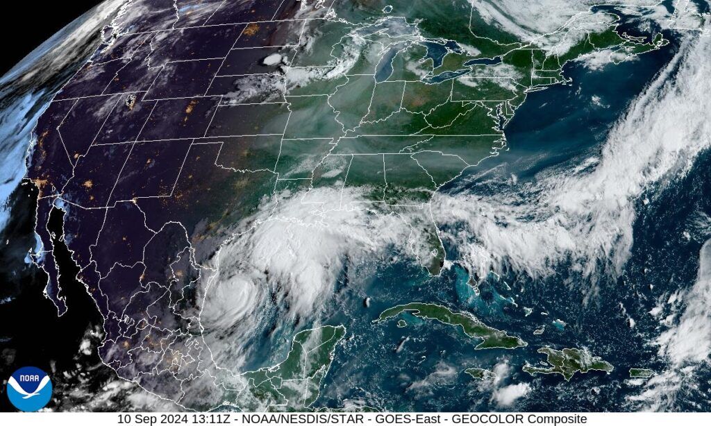
- A satellite image of Tropical Storm Francine as of 8:11 a.m. Tuesday, Sept. 10, 2024.
Hurricane warnings have been extended to Terrebonne and Lafourche parishes as Tropical Storm Francine continues her path toward the Louisiana coast, with forecasters noticing the system gradually track east.
While the National Hurricane Center forecast as of 7 a.m. still placed Francine’s path toward Acadiana, WVUE-TV Fox 8 meteorologist Zach Fradella said updated computer models show the storm edging eastward. He expects the official forecast track to be moved in that direction in the NHC’s 10 a.m. update, so residents in Southeast Louisiana should prepare for impacts for a Category 1 or 2 hurricane.
Trending
Parishes along the Louisiana coast have issued evacuation orders for residents outside of levee protection, as Francine is expected to bring a storm surge ranging from 5 to 10 feet in the area between Cameron to Port Fourchon.
Cameron Parish has ordered a mandatory evacuation for all residents. Plaquemines Parish is urging everyone in the lower parts of the parish to leave, followed by east bank residents below Alliance.
In addition to storm surge, Francine’s greatest impact is expected to be power outages. Officials recommend residents with generators exercise caution, checking the status of carbon monoxide monitors before the storm arrives.