Tropical Storm Laura emerging as larger threat than still dangerous Marco
Published 6:42 pm Sunday, August 23, 2020
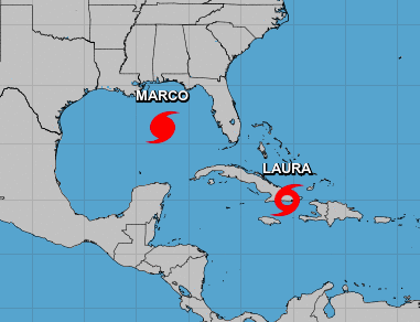
- Marco and Laura
Although Hurricane Marco is still a Category 1 storm, the latest National Weather Service updates show more concern for Tropical Storm Laura as Marco continues to shift its course westward.
According to the National Hurricane Center’s 4 p.m. guidance Sunday, Marco may not make landfall in southeast Louisiana on Monday. Instead, it may move west across southern Louisiana or the adjacent coastal waters, weakening as a tropical storm.
Because of this forecast change, a tropical storm warning is now in place as far west as Cameron.
Tropical Storm Laura is expected to reach hurricane status early Wednesday morning as it approaches the Louisiana coast. But even that is not a certainty. The cone of uncertainty for Laura’s landfall ranges from southeast Louisiana on Wednesday to southeast Texas on Thursday, potentially as a major hurricane.
The forecast for Laura predicts hurricane force winds possible across the region starting late Wednesday and continuing Thursday.
At the coast, the storm surge could be more than 10 feet above ground level. Depending on where Laura makes landfall, storm surge can back up rivers and bayous and flood over 30 miles inland. Depending on where the rain bands form, 5 to 10 inches is expected, with the possibility of 15 inches locally starting Wednesday into Thursday.
As for Marco, tropical storm force winds could occur from Cameron eastward along the coast, possibly extending inland to the I-10 corridor, as early as late Monday or early Tuesday south central Louisiana and during the day Tuesday for southwest Louisiana. Water 1 to 3 ft above ground level is possible for the southwest and south central Louisiana coast starting late Monday and into Tuesday. Depending on where the rain bands form, local amounts of 2 to 4 inches are possible Tuesday.