Hurricane Realities & Reasons
Published 8:00 am Tuesday, June 7, 2016
- Hurricane Realities & Reasons
By Amanda Jean Harris
Be prepared. It’s a simple set of instructions when it comes to hurricane season, but people want predictions. We like to know what the weather is going to do and perhaps no more so each year in Acadiana than between the months of June and November.
Trending
br
If you’ve lived through one hurricane season around here – you’ve lived through one hurricane season around here. Each one is like a child — unique and unpredictable. The area’s leading expert concerning the complex hurricane prediction elements, Rob Perillo, weighs in on what our hard-to-predict recent weather means as we approach the most speculated few months of the year.
br
We start with the Atlantic Basin and what the activity in that area could mean for our local forecasts.
br
“I like to say it’s of interest to know how busy the Atlantic Basin is going to be,” Perillo says.
Trending
br
Yet, the direct link in practical terms doesn’t show definitely if we are going to have an average or an above or below average hurricane season on the Louisiana coast. The man at the helm of the weather team at KATC TV 4 says El Nino versus La Nina is another element that can impact predictions.
br
El Nino tells us we will see below normal activity, Perillo says, yet it’s a “big wild card” along with the pressure levels in the Caribbean and the dust patterns in Africa’s tropical monsoon areas.
br
“That can all give us an idea of how the season is going to go,” Perillo says. “With all of that being said, the Gulf of Mexico activity has very little statistical inference. The Gulf is always a wild card no matter what the Atlantic Basin is going to be. We think El Nino is fading and maybe going to La Nina or neutral. Winds blow stronger and knock down the number of storms and increasing storm sheer, the door is a little more open for activity in the Western Caribbean and Gulf of Mexico.”
br
One of the other factors, Perillo says — the much below normal temperatures in the Northern Atlantic and that should also work into the Easter Tropical Atlantic, which would knock down the number of storms perhaps developing in the far Atlantic, which are usually the big blockbuster storms.
br
The long story short: we are looking at a “near normal hurricane season,” according to Perillo.
br
“It could be a very busy season for Louisiana or for the Atlantic and not much in Louisiana. We can’t say this with statistical surety,” he says.
br
Another factor many consider when it comes to the Gulf hurricane predictions has to do less with any meteorological factor, but rather statistics.
br
“There’s not been much in the Gulf since 2008 … for 8 years there’s been below normal activity in the Gulf and we’ve been 10 years without a major hurricane striking us. Statistically we are kind of getting due. But, what happens isn’t a precursor of the future.”
br
Perillo says the past doesn’t dictate the future when it comes to weather predictions. People can’t expect to have a quiet season because the last was active, for example.
br
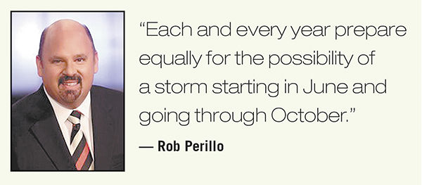
“Each and every year prepare equally for the possibility of a storm starting in June and going through October,” Perillo says.
br
When it comes to statistics there are a few that are facts year after year: We average a tropical storm about once a year and there is a 90 percent chance it will strike.
br
Tropical storms can be as devastating as a hurricane if it’s slow moving and dumping heavy rains and fierce winds in one area.
br
It’s typical that hurricanes come around every 3 to 5 years.
br
“The last several years we haven’t had anything. The last one was Isaac in 2012. We are getting close to that and every other hurricane that hits our coast is a major hurricane, which is an every 10 to 20 year period. I think it would be a fair statement that we would see more action in the Gulf whether it’s Florida or Texas or we are in play,” Perillo says.
br
But, there is no statistic that can predict our season with certainty.
br
“Just because we haven’t had a storm in awhile it doesn’t mean we are due,” Perillo says. “Be aware starting June 1. Our prime time is the third week of August through the first of October.”
br
The last massive storms came in 2005 with back-to-back Katrina and Rita and then in 2008 Gustav and Ike hit. Perillo points toward a year we even had three hurricanes in a mere 7-week period. Proof that even a massive storm late in the season doesn’t mean it’s time to pack up the generator.
br
“Be prepared and don’t be surprised if we have more than one scare,” he says.
br
Perillo has been a part of the Gulf Coast area working during hurricane season for 30 years. A New Yorker whose specialty was lake effect snow learned the tropics quickly and today is an expert on the matter. He’s presently working on a paper about surviving three decades on the Gulf.
br
In those years, much has changed in the ways meteorologists gather information and the way news stations disseminate that information and the way viewers share all this information, which is more accessible than ever.
br
“The information flow has changed even since 2005 when we didn’t have social media. We didn’t have apps that pushed to phones,” Perillo says.
br
More and more people are using their phones for weather needs and even breaking information and news coverage.
br
“There are new challenges on getting information in and out and to the consumers and viewers,” Perillo says.
br
He says to look for trusted sources. Anyone can write a blog or use nationally published data to make predictions without the actual knowledge or training to look at the big picture.
br
“It’s hard for the consumer to know if a hurricane tracker page is legitimate,” he says. “Always question the source of your information.”
br
With all the information available it’s more important than ever to understand the importance of where information is coming from and how that person is filtering it.
br
“A lot of people are interpreting models that have no business of doing it and it’s bad information. You need a degreed meteorologist to filter through the noise. Stay with your trusted source and follow that,” Perillo says.
br
While Perillo certainly uses his experience and education to make predictions, he says it is never his job to out guess the National Hurricane Center, but rather to utilize those resources and other models to give our local residents the best information possible.
br
In addition to the tried and true services of the National Hurricane Center, the standard in weather watching has a new offering: Surge watches and warnings.
br
“If there is a storm down in Texas, we could see hurricane surge and we will see surge watches and warnings, which is very important because we can get a significant, damaging surge,” Perillo says.
br
For example, if a hurricane hits as far as somewhere like Corpus Christi we could still see 10 feet of water on the Louisiana coastline.
br
“They [National Hurricane Center] are consistently working on how to get the message out and they continue to improve and make our jobs easier,” he says.